Downloadable Course Map and Profile by Robbie Warner

Aid Stations

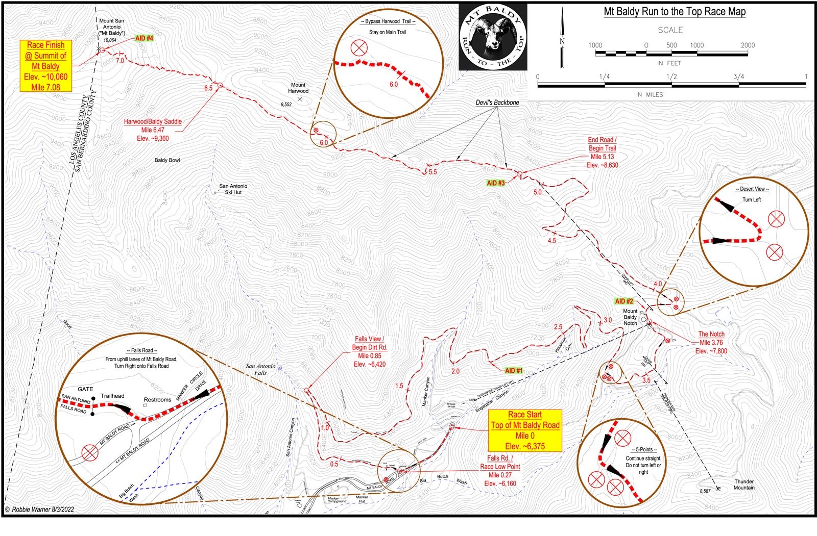
7+ mile trail run with 4,000 feet of elevation gain. Beginning at about 6,000 feet elevation, the first 1st mile is on paved roadway. This is followed by 3 miles of uphill grade on a dirt service road that travels through a forested canyon and continues above the Mt. Baldy Ski Lifts till it reaches the Devil’s Backbone Trail. The next 3+ miles begin with a narrow “catwalk” along the Devil’s Backbone. Then the trail opens up near Mt. Harwood and trees and other vegetation begin to thin out. The final mile, the steepest, is above timberline. The finish line is atop beautiful Mt. San Antonio (Mt. Baldy) at 10,064 feet. Walk back from the summit to the Notch near Aid Station #2 and enjoy a scenic ride on the Mt. Baldy Ski Lifts down to the parking lot.